IT Systems and Spatial Solutions Development for Companies in Kampala
What are IT Systems and Spatial Solutions Development Services
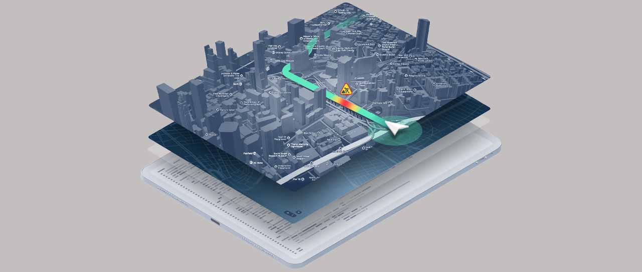
IT Systems and Spatial Solutions Development refers to designing, creating, and implementing information technology (IT) systems that incorporate spatial or geographical components. This specialized field combines traditional IT solutions with spatial data and technologies to address specific needs related to location-based information, mapping, and geospatial analysis.
Breakdown of the key components for IT Systems and Spatial Solutions Development
-
IT Systems Development:
– Custom Software Development: Creating bespoke software solutions tailored to the unique requirements of an organization. This may include applications, databases, and other IT systems.
– Integration of Existing Systems: Connecting and integrating different IT systems within an organization to ensure seamless data flow and communication between various components.
-
Spatial Solutions Development:
– Geographic Information Systems (GIS): Designing and implementing GIS applications that allow organizations to capture, analyze, and visualize spatial or geographic data. GIS can be used for mapping, spatial analysis, and decision-making.
– Location-Based Services (LBS): Developing applications and services that utilize location information to provide relevant and personalized content or functionality to users.
– Geospatial Intelligence (GEOINT): Implementing solutions that involve the analysis of geospatial data for intelligence and decision-making purposes, often used in defence, security, and emergency response applications.
-
Collaboration and Communication:
– Collaboration Platforms: Developing tools and platforms that facilitate collaboration and communication among teams, especially when dealing with spatial data and information.
– Visualization Tools: Creating tools that enable the visualization of complex spatial data in a user-friendly manner, aiding in better understanding and interpretation.
-
Data Management and Analysis:
– Spatial Data Management: Developing systems for the efficient storage, retrieval, and management of spatial data, ensuring accuracy and reliability.
– Spatial Analysis Tools: Designing tools and algorithms for analyzing spatial data, extracting meaningful insights, and supporting decision-making processes.
-
Innovation and Emerging Technologies:
– Integration of Emerging Technologies: Incorporating emerging technologies like artificial intelligence, machine learning, and the Internet of Things (IoT) into spatial solutions for enhanced capabilities and functionalities.
– Continuous Improvement: Keeping up with advancements in IT and spatial technologies to ensure solutions remain innovative and aligned with industry best practices.

Why Choose Isazeni Solutions for IT Systems and Spatial Solutions Development?
-
Tailored Solutions for Your Business:
– At Isazeni Solutions, we understand that every business is unique. Our approach revolves around delivering customized IT systems and spatial solutions that align precisely with your specific business objectives and challenges.
-
Innovation as a Core Value:
– We take pride in our commitment to innovation. Isazeni Solutions ensures that your company stays ahead of the competition by leveraging the latest technologies in IT systems and spatial solutions development. We strive to enhance your business processes and boost overall efficiency at every step.
-
Expertise in Spatial Solutions:
– Our dedicated team brings unparalleled expertise in spatial solutions. This translates to your business benefiting from advanced mapping, location-based analytics, and geospatial intelligence. Harness the power of spatial data to gain valuable insights and make informed decisions.
-
Collaborative Approach:
– Collaboration is key to success. At Isazeni Solutions, we value and prioritize a collaborative approach. We work closely with your team to thoroughly understand your vision and goals. This ensures that the IT systems and spatial solutions we develop seamlessly integrate into your existing workflow, enhancing efficiency across the board.
Key Features of Our IT Systems and Spatial Solutions Development Services:
Customized Solutions:
– Isazeni Solutions believes in providing tailor-made solutions that precisely match the unique needs of your business. Our IT Systems and Spatial Solutions are crafted to address your specific challenges, fostering a solution that aligns seamlessly with your operational requirements.
Innovation at Every Step:
– Our commitment to innovation extends throughout the development process. From concept to execution, we leverage the latest technologies to ensure that the solutions we deliver not only meet but exceed your expectations, setting your company apart in the competitive landscape.
Expertise in Spatial Solutions:
– Isazeni Solutions boasts a team with specialized expertise in spatial solutions. By incorporating advanced mapping, location-based analytics, and geospatial intelligence, we empower your business with tools that provide a unique perspective, enhancing decision-making processes.
Collaborative Approach:
– Collaboration is woven into the fabric of our services. Isazeni Solutions collaborates closely with your team, ensuring that the solutions we provide seamlessly integrate into your existing workflow. This collaborative approach guarantees a smooth implementation and ongoing support.
Choosing Isazeni Solutions for IT Systems and Spatial Solutions Development means choosing a partner dedicated to your business’s success. Transform your operations, enhance efficiency, and embrace innovation with our comprehensive IT systems and spatial solutions. Contact us today to embark on a journey of technological advancement tailored to your company’s unique needs.
Request a Consultation for Your Business
Benefits and importance of IT Systems and Spatial Solutions Development
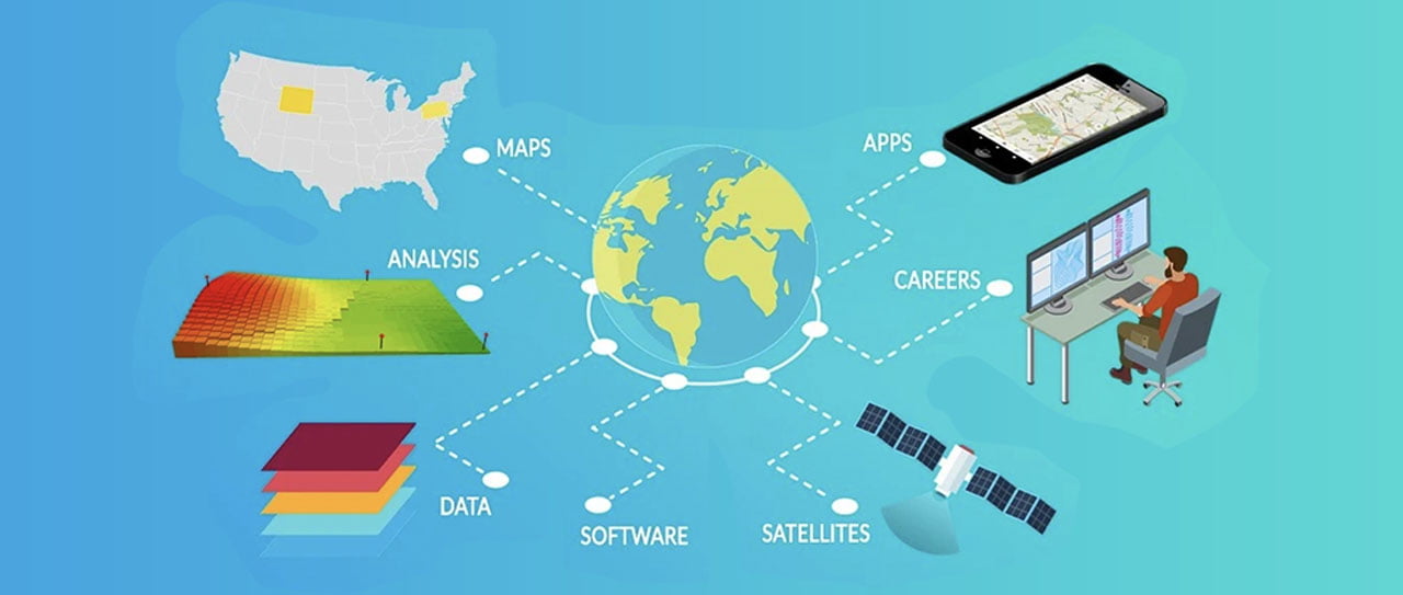
IT Systems and Spatial Solutions Development bring immense value to organizations and government institutions by facilitating informed decision-making, optimizing resource allocation, improving service delivery, supporting disaster management, fostering sustainable development, and enhancing overall efficiency and effectiveness in various aspects of operation and governance.
Top 10 benefits and importance of IT Systems and Spatial Solutions Development for organizations and government institutions:
-
Enhanced Decision-Making:
IT Systems and Spatial Solutions enable organizations to make data-driven decisions by visualizing complex spatial data. This aids in understanding patterns, trends, and relationships, leading to more informed and effective decision-making processes.
-
Optimized Resource Allocation:
Through spatial analysis, organizations can better allocate resources based on geographic needs. This includes deploying personnel, managing infrastructure, and distributing services efficiently across different geographic areas.
-
Improved Planning and Development:
Spatial solutions aid in urban planning, infrastructure development, and land use management. Government institutions can plan smarter cities, optimize transportation routes, and ensure sustainable development by leveraging spatial data.
-
Disaster Response and Management:
IT Systems and Spatial Solutions play a critical role in disaster response and management. Governments can use these tools to assess risks, plan evacuation routes, and coordinate emergency response efforts more effectively.
-
Efficient Service Delivery:
For government institutions, spatial solutions optimize service delivery. They enable the mapping of service coverage areas, ensuring that citizens receive services efficiently, whether it’s healthcare, education, or public utilities.
-
Environmental Management:
Spatial solutions aid in monitoring and managing environmental resources. This includes tracking deforestation, managing wildlife habitats, monitoring pollution, and assessing the impact of climate change.
-
Infrastructure Maintenance and Management:
Organizations can better manage infrastructure assets like roads, bridges, and utilities by utilizing spatial solutions for maintenance scheduling, identifying vulnerable areas, and optimizing repair and maintenance activities.
-
Improved Public Safety and Security:
Spatial solutions contribute to enhancing public safety and security by mapping crime patterns, monitoring critical infrastructure, and planning emergency response protocols, thereby aiding law enforcement agencies and first responders.
-
Support for Economic Development:
By leveraging spatial data, businesses and government institutions can identify optimal locations for new businesses, analyze market trends, and attract investments, contributing to economic growth and development.
-
Citizen Engagement and Transparency:
Spatial solutions can be used to create interactive maps and platforms that engage citizens, promoting transparency and accountability in government operations. Citizens can access information about public services, projects, and initiatives.
Transparent Pricing Model for IT Systems and Spatial Solutions Development packages:
Cere’s a sample estimation with a table for IT Systems and Spatial Solutions Development packages. Please note that these are general estimates, and the actual prices can vary based on specific project requirements, technology choices, and other factors.
NO. |
Package |
Description |
Features Included |
Estimated Price |
| 1 | Basic Package | Small businesses with limited spatial needs | Standard features and functionalities | $5,000 – $15,000 |
| 2 | Standard Package | Medium-sized businesses with moderate spatial requirements | Advanced mapping, basic geospatial analytics | $15,000 – $50,000 |
| 3 | Advanced Package | Larger enterprises with complex spatial requirements | Geospatial intelligence, comprehensive analytics | $50,000 – $150,000 |
| 4 | Custom Package | Organizations with highly specific or unique spatial challenges | Tailored features, detailed consultation, custom development | $100,000 and above |
| 5 | Subscription Model | Ongoing support, maintenance, and updates for a subscription fee | Continuous improvement and updates | $2,000 – $10,000/month |
| 5 | Consultancy & Training Package | Additional services such as consultation and training | Expert consultancy, staff training | Custom Quote |
These estimations are meant to provide a general idea, and it’s crucial for Isazeni Solutions to conduct a detailed needs assessment to provide accurate quotes based on the specific requirements of each client. Transparent pricing and a breakdown of costs should be provided to ensure clarity and build trust with potential clients.
IT Systems and Spatial Solutions Development Approach:
At Isazeni Solutions, our approach to IT Systems and Spatial Solutions Development is founded on precision, innovation, and collaboration. We tailor our process to ensure your unique business needs are not just met but exceeded. Here’s a glimpse into our comprehensive approach:
1. Needs Assessment:
Our journey begins with a detailed needs assessment. We collaborate closely with your team to understand your business objectives, challenges, and specific requirements. This in-depth analysis forms the foundation for a tailored solution.
2. Customized Solution Design:
Armed with insights from the assessment, we design a bespoke solution crafted exclusively for your business. Whether it’s enhancing existing systems or building new spatial solutions, our team ensures that every detail aligns with your vision and objectives.
3. Innovation Integration:
Innovation is at the core of our development process. We seamlessly integrate the latest technologies, ensuring your IT systems and spatial solutions are not just up-to-date but ahead of the curve. Our goal is to empower your business with tools that drive efficiency and provide a competitive edge.
4. Agile Development and Iteration:
We adopt an agile development methodology, allowing for flexibility and adaptability throughout the process. Regular iterations and feedback loops ensure that the solution evolves in line with your changing business landscape.
5. Thorough Testing and Quality Assurance:
Before deployment, every solution undergoes rigorous testing and quality assurance. Our commitment to delivering reliable, bug-free systems guarantees a smooth transition into your operational environment.
6. Collaborative Implementation:
The collaboration doesn’t end with development. Our team actively supports the implementation phase, ensuring a seamless integration of the IT systems and spatial solutions into your existing workflow. We work closely with your team to address any challenges and provide comprehensive training.
7. Ongoing Support and Optimization:
Our relationship doesn’t end at deployment. Isazeni Solutions is committed to providing ongoing support and optimization services. We monitor system performance, address any issues promptly, and work towards continuous improvement to keep your solutions at the forefront of technology.
100 Frequently Asked Questions (FAQs) on IT Systems and Spatial Solutions Development Services:
1. What is IT Systems and Spatial Solutions Development?
2. How can spatial solutions benefit businesses in Uganda?
They help businesses make decisions based on where things are located, like finding the best place for a store or optimizing delivery routes.
3. Are spatial solutions only relevant for large enterprises?
4. Can small businesses in Kampala afford IT Systems development services?
5. What industries can benefit most from spatial solutions?
6. How do IT Systems contribute to improving operational efficiency?
7. Are IT Systems and spatial solutions suitable for government institutions?
8. Can spatial solutions be customized for specific industry requirements?
9. What role do IT Systems play in data-driven decision-making?
10. How long does it typically take to develop a customized IT system?
11. Are there any ready-made templates for spatial solutions?
12. Can spatial solutions be integrated into existing business operations seamlessly?
13. How can IT Systems support disaster response and management?
14. What technologies are commonly used in spatial solutions development?
15. Can spatial solutions assist in optimizing transportation routes in urban areas?
16. How do IT Systems contribute to the economic development of businesses?
17. What considerations should businesses make when choosing spatial solutions?
18. How can IT Systems be adapted for use in remote or off-grid locations?
19. Are there any grants or funding opportunities for spatial solutions development?
20. What are the key challenges in adopting GIS technology for businesses?
21. Can spatial solutions be used for environmental monitoring and sustainability?
22. How do IT Systems contribute to enhancing public safety and security?
23. Can spatial solutions be integrated with Internet of Things (IoT) devices?
24. What are the potential benefits of using cloud-based GIS systems?
25. How do businesses in Kampala benefit from location-based analytics?
26. Can spatial solutions be utilized for real-time tracking and monitoring?
27. What considerations should businesses make for data security in spatial solutions?
Businesses should ensure encryption of sensitive data, secure user access, and regular updates to protect against cyber threats.
28. How can IT Systems be customized to comply with industry regulations?
29. What types of maintenance services are typically offered for IT Systems?
30. Can spatial solutions assist in optimizing supply chain logistics in Uganda?
Yes, spatial solutions can help optimize routes, manage inventory, and track goods across the supply chain.
31. How do IT Systems contribute to improving customer experiences?
32. What are the key features to look for in a spatial solutions provider?
33. Can IT Systems support the integration of geospatial data with business intelligence?
34. How can businesses ensure the scalability of spatial solutions for future growth?
35. What types of analytics and reporting are available in spatial solutions?
36. How do businesses ensure the long-term sustainability of IT Systems?
37. Can spatial solutions be customized for agricultural applications in Uganda?
38. How do IT Systems contribute to optimizing resource allocation?
39. Are there any training programs available for businesses adopting spatial solutions?
40. What are the potential risks associated with IT Systems and spatial solutions development?
41. Can spatial solutions be used for public health monitoring in Uganda?
42. How can businesses effectively manage the integration of spatial solutions into their workflow?
43. What are the key considerations for businesses in choosing a GIS platform?
44. Can IT Systems be integrated with existing enterprise resource planning (ERP) systems?
45. How can businesses address challenges related to data interoperability in spatial solutions?
46. Can spatial solutions be used for market analysis and strategic planning?
Yes, businesses can use spatial data to analyze customer demographics, market trends, and competitor locations.
47. How do businesses handle potential challenges related to data standardization in IT Systems?
48. What role does machine learning play in the development of spatial solutions?
49. Can businesses utilize spatial solutions for wildlife conservation efforts?
50. How does IT Systems contribute to monitoring and managing utility infrastructure?
51. Can spatial solutions be used for land-use planning and development in urban areas?
Yes, spatial solutions help planners design efficient cities, optimize infrastructure, and ensure sustainable land use.
52. How do businesses ensure the accessibility of GIS data for users in spatial solutions?
53. What environmental impacts should businesses consider during IT Systems development?
54. Can spatial solutions be adapted for use in diverse geographic and cultural settings?
55. How do businesses handle potential issues related to data privacy laws in spatial solutions?
By ensuring that all personal and sensitive data is stored and managed in compliance with local laws and regulations.
56. What types of security measures are typically implemented in IT Systems development?
57. Can spatial solutions be used for real-time monitoring of air quality in urban areas?
58. How can businesses address potential challenges related to data synchronization in IT Systems?
59. What are the potential advantages of using a modular development approach for spatial solutions?
60. How do businesses handle user training and onboarding for employees adopting IT Systems?
61. Can spatial solutions be utilized for disaster preparedness and response in Uganda?
62. How does IT Systems contribute to optimizing and managing inventory and assets?
63. What types of consulting services are available to businesses considering spatial solutions?
64. Can businesses use spatial solutions for monitoring and managing natural resources?
65. How does IT Systems support the integration of geospatial data with business intelligence tools?
66. Can businesses effectively communicate the benefits of spatial solutions to their stakeholders?
67. How can IT Systems contribute to improving collaboration and communication within organizations?
68. What types of analytics and insights can businesses gain from spatial solutions?
69. Can spatial solutions be utilized for optimizing transportation routes and logistics in Uganda?
70. How do businesses ensure that GIS applications are user-friendly for non-technical users?
71. What considerations should businesses make for scalability in IT Systems development?
72. Can spatial solutions be integrated with external databases and third-party software?
73. How do businesses address potential challenges related to the accuracy of spatial data in GIS applications?
74. What role does open-source GIS technology play in spatial solutions development?
75. Can businesses use spatial solutions for monitoring and managing wildlife habitats?
76. How do IT Systems contribute to improving planning and development for businesses?
77. What potential environmental benefits can businesses achieve through spatial solutions?
78. Can spatial solutions be customized for compliance with industry regulations and standards?
79. How does IT Systems support businesses in enhancing data-driven decision-making processes?
80. What types of collaborations can businesses establish with technology vendors for spatial solutions?
81. Can spatial solutions be used for real-time tracking and monitoring of assets in diverse industries?
82. How do businesses handle potential challenges related to data standardization in spatial solutions?
Businesses can adopt industry standards and work with experts to ensure consistency and accuracy across different datasets.
83. What are the potential advantages of using a cloud-based GIS system for businesses?
84. Can IT Systems be integrated with business intelligence tools for more comprehensive insights?
85. How do businesses ensure the long-term sustainability of GIS applications and spatial solutions?
86. Can spatial solutions be customized for compliance with specific data privacy laws in Uganda?
87. What are the key features to consider when choosing a spatial solutions provider for businesses?
88. How can businesses effectively communicate the benefits of IT Systems to their stakeholders?
89. Can spatial solutions be used for environmental monitoring and sustainability efforts in Uganda?
90. How do businesses ensure the scalability of GIS applications for future growth and expansion?
Businesses should choose GIS platforms that can easily handle increasing data volumes and offer expansion options as the business grows.
91. Can IT Systems support businesses in optimizing supply chain logistics and distribution?
92. How do spatial solutions contribute to enhancing public safety and security in urban areas?
93. What types of maintenance services are typically offered for GIS applications and IT Systems?
94. Can businesses use spatial solutions for real-time monitoring of air quality and pollution?
95. How do IT Systems contribute to optimizing and managing inventory and assets for businesses?
96. What types of consulting services are available for businesses considering the adoption of spatial solutions?
97. Can spatial solutions be used for wildlife conservation efforts and environmental protection?
98. How do businesses handle potential challenges related to data synchronization in IT Systems?
99. What are the potential advantages of using a modular development approach for GIS applications and spatial solutions?
100. Can IT Systems be integrated with external databases and third-party software for seamless operations?
TECHNOLOGY PARTNERS WE USE IN WESITES & RELATED SERVICES
For years we have acquired strategic partnerships enabling us to serve you better
Ready to start on your project? let’s jump into it.


